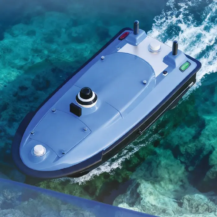
The Tboat20 unmanned vessel platform is capable of meeting 99% of industry demands in aquatic operations. Its multifunctional design supports a wide range of application scenarios, including underwater full-terrain topography measurement, hydrographic flow measurement, underwater stratum monitoring, water quality sampling, environmental monitoring, water body apparent spectrum survey, and integrated air-land-water mobile monitoring of water environments. This platform achieves "one vessel, multiple applications," featuring high automation, strong disturbance resistance, and extensive hull expandability. It significantly enhances the efficiency and precision of unmanned aquatic operations, providing an efficient and reliable solution for intelligent water-based tasks.
High-Precision Navigation System
The Tboat20 features full-system multi-frequency signal tracking, enabling its antenna to receive signals from all major global constellations including BDS, GPS, GLONASS, GALILEO, SBAS, and QZSS. This robust signal reception, processed by proprietary high-precision algorithms, ensures exceptional straight-line stability and steady operation.
High-Intensity
It adopts a full-curved V-shaped hull, made of high-molecular polyester fiber and Kevlar fabric, with IP67 waterproof and dustproof rating. It is equipped with omnidirectional anti-collision strips, and the bow and hull bottom are reinforced with anti-collision design, which can adapt to complex water environments and is durable.
Long Endurance
It is equipped with brushless dual motors with a maximum power of 1100W and supports multiple speed modes. It is equipped with 33.6V/25Ah*2 dual rechargeable lithium batteries, with a cruising range of up to 7 hours, providing strong power and meeting the needs of long-term operations.
Convenient and Efficient
It is equipped with a one-button start system, and the balanced battery supply increases the cruising range by 20%. It is equipped with a Linux operating system, supports 4G/2.4G data communication, has a variety of interfaces, and is convenient for remote control. The operation data is displayed in real time.
One Boat for Multiple Purposes
Equipped with devices such as side-scan sonars, multibeam echo sounders, ADCP, and in-situ analyzer, it can carry out underwater topographic and geomorphic survey, hydrological flow measurement, water quality sampling, environmental monitoring and other operations, meeting 99% of the industry needs in water area operations and achieving "one boat for multiple uses".